ALERTCalifornia

Prepare · Respond · Recover

Developing Technology to Stay Ahead of Natural Disasters

ALERTCalifornia

Prepare · Respond · Recover

Developing Technology to Stay Ahead of Wildfires

Based at the University of California San Diego, ALERTCalifornia is a public safety program working to understand natural disasters and determine short and long-term impacts on people and the environment to inform management decisions.

ALERTCalifornia is a UC San Diego Program

VIEW LIVE CAMERA FEEDS

Cameras and sensors are deployed throughout California to monitor wildfires and disasters in real-time. 

camera-live-feed2

TESTIMONIALS

“It used to take 20 to 30 minutes for our fire ground commanders to get to fires and make decisions, and now with the cameras we are reacting within seconds of the first report… It’s making a difference. I can’t even put into words how important those first few minutes are.”
TONY MECHAM
CAL FIRE San Diego County Unit Chief
“Over the past two years, the ALERTCalifornia cameras in our unit have significantly improved the situational awareness of our response personnel on wildland fire calls throughout the unit.”
RICHARD SAMPSON
CAL FIRE Division Chief – Unit Forester
San Mateo-Santa Cruz Unit
"The cameras have been an invaluable resource for us, especially in areas where aviation weather reporting is unavailable, such as the rural regions we fly through. They have greatly aided us in making safe decisions regarding weather conditions, allowing us to transport our patients safely. Just this morning, in fact, we were able to utilize the cameras to show us a massive fog bank that is not showing up on the weather stations available to us."
MARQUIS LUTGE
FP-C Flight Paramedic, Base Safety Rep

LIVE MAP

CAMERA FEEDS

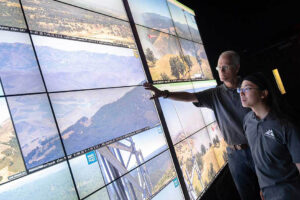
ALERTCalifornia has more than 1,080 high-definition, pan-tilt-zoom cameras deployed across California (as of June 2024), providing a 24-hour backcountry network with near-infrared night vision to monitor disasters such as active wildfires. ALERTCalifornia cameras can perform 360-degree sweeps approximately every two minutes and can view as far as 60 miles on a clear day and 120 miles on a clear night. Explore our “camera quilt” to view live camera feeds and for more details on camera and network status.

LOCATIONS

INSTALLATIONS

ALERTCalifornia has an extensive, ever-expanding camera network in California. Researchers at UC San Diego have taken the lead in creating the cyberinfrastructure to process, store, manage and visualize the massive amounts of incoming data from these camera installations. Our discoveries help mitigate the impact of wildfires on people and property, and bolster research into how to best prepare and respond to wildfire threats, both before, during and after serious burn events. 

ALERTCalifornia

TECHNOLOGY

As the ALERTCalifornia camera network and cyberinfrastructure grow in size and sophistication, UC San Diego researchers are using cutting-edge technology to gain insight into changing natural disaster patterns in the West. ALERTCalifornia provides state-of-the-art technology that supports data-driven decisions to prepare for, respond to, and recover from natural disasters.

THE LATEST FROM ALERTCalifornia

VIDEO

TWITTER

Load More